|
|
|
|
|
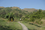
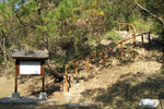
Start of the trail, near the toll gate of Tai Lam Tunnel.
|
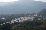
| Looking back at the toll gate.
|
| | From left to right: Tai To Yan, Kwun Yam Shan and Tai Mo Shan. 大刀屻, 觀音山, 大帽山
|
|
|
|
|
|
|
| Take a group photo of them.
|
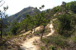
| A 220m hill around Shap Pat Heung 十八鄉
|
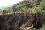
| Most of the slopes are eroded
|
|
|
|
|
|
|
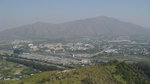
The plain of Yuen Long 元朗 and Tin Shui Wai 天水圍. Kong Sham Western Highway 港深西部公路 was too faint to be seen in this photo.
|
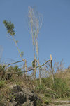
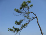
| Many trees there were inclinded by wind.
|
| This became the wallpaper of my desktop.
|
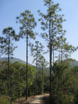
| There were a few tall pines.
|
|
|
|
|
Finish of the Tai Lam Chung Country Trail, we went to Tai Tong 大棠 through the Yuen Tsuen Ancient Trail 元荃古道.
|
| |
|
|
|
|
|
|
|
|
|
|