|
|
|
|
|
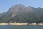
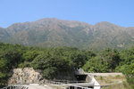
Lantau Peak and Kau Nga Ling 鳳凰山, 狗牙嶺, view from Shek Pik Reservoir 石壁水塘.
|
| From right to left: Kwun Yam Shan, Keung Shan and Ling Wui Shan 觀音山, 羌山, 靈會山, view form Tung Wan 東灣, outside the Youth Camp .
|
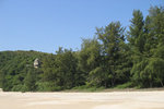
| The Beach of Lo Kei Wan 籮箕灣
|
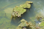
| On the river, there are islands of floating alga.
|
|
|
|
|
|
|
| From left to right: Lantau Peak, Sunset Peak and Shui Hau Wan 鳳凰山, 大東山, 水口灣.
|
| The pass on the right is 南天門.
|
| Shui Hau peninsula and Tong Fuk 水口半島, 塘福, view from the catch water of stage 10.
|
|
|
|
|
|
|
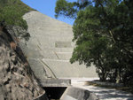
Here is the slope that I've walked pass
|
| when it slided back in 1995.
|
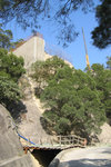
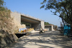
| Passing the construction site of the bypass of Tung Chung Road 東涌道.
|
| |
|
|
Pui O and the Chi Ma Wan Peninsula 貝澳, 芝麻灣半島, with the moon on the left.
|
|
|
|
|
|
|
|
|
|
|
|