|
|
|
|
|
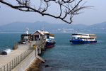
The only pier at Tung Ping Chau
Viewed: 122 times.
|
| 大塘灣 Tai Tong Wan, along the east coast
Viewed: 46 times.
|
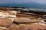
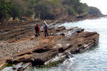
| 長沙灣 Cheung Sha Wan, along the east coast
Viewed: 69 times.
|
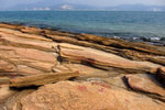
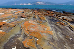
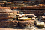
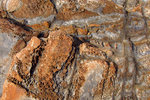
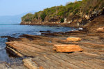
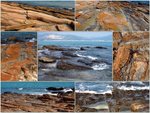
| Rock structure, in layers
Viewed: 47 times.
|
|
|
|
|
|
|
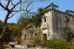
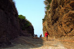
A deserted house on the east coast
Viewed: 20 times.
|
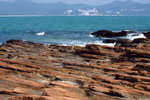
| NE coast of Tung Ping Chau
Viewed: 23 times.
|
| | |
|
|
|
|
|
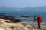
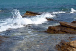
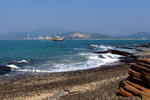
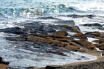
| | | Spot for shooting waves
Viewed: 108 times.
|
|
|
|
|
|
|
| 洲尾角 Chau Mei Kok, at the NE corner of Tung Ping Chau
Viewed: 20 times.
|
| 斬頸洲 Cham Keng Chau, along the NW coast of Tung Ping Chau
Viewed: 16 times.
|
| |
|
|
|
|
|
Kei & Eiling at Cham Keng Chau
Viewed: 22 times.
|
| 龍落水 Lung Lok Shui, on the west coast
Viewed: 57 times.
|
| Tung Ping Chau
16JAN2011
Viewed: 61 times.
|
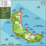
| Map of Tung Ping Chau (from HK Geopark website)
Viewed: 55 times.
|
|
|
|
|
|
|
|
|
|